About this place
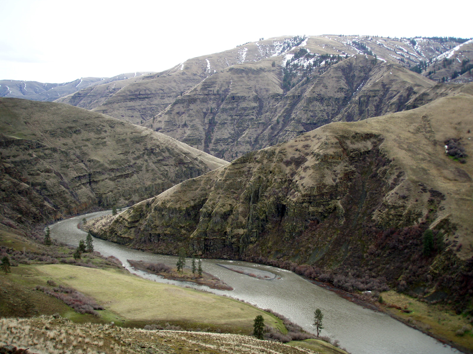
Ten miles of the Wallowa and eighty of the Grande Ronde, running from Minam in Oregon down to Heller Bar over the line in Washington. They share a page because they're managed as one corridor, and because you won't notice much changing where one becomes the other.
The stretch from Minam to the Oregon-Washington line is a National Wild and Scenic River. It is an Oregon State Scenic Waterway too. Three agencies look after it: the Bureau of Land Management, the Forest Service, and Oregon Parks and Recreation.
Running it
Most people put in on the Wallowa at Minam and let it carry them into the Grande Ronde. Two or three days is the usual trip, and shorter or longer works if you plan for it.
The other ways on and off are Wildcat Bridge, which you'll hear called Powwatka, plus Mud Creek, Troy, Boggan's Oasis and Shumaker.
Nothing dams these rivers, so the water does whatever the weather tells it to, and it can change inside a day. Through the main floating season you're looking at 2,000 to 10,000 cubic feet per second.
Spring and early summer bring the fast water, when warm weather and rain strip the snow off the mountains. By mid-July it has usually dropped away, and it stays shallow and slow through fall and winter with a lot more rock showing.
Get current river and weather information the day you go. Nobody can tell you in advance what you'll find.
If you'd rather not share it, stay off weekends and holidays between the middle of May and early July.
Roads, fuel and phone signal
The shuttle between put-in and take-out often runs on rough roads, and you'll want to read a map or run a GPS properly. Some of those roads aren't maintained and some are impassable. The only way to know which is to ask somebody local that morning.
Out here fuel, food and services are often not available at all, and cell coverage generally isn't either, anywhere in the canyon.
Carry spare fuel, food, water and a spare tire. Tell somebody where you're going and when you expect to be back.
Before you go
- Camping along the river is primitive and first come, first served. In the busy season there's real competition for the good spots. Going midweek or out of season is the difference between choosing a site and taking what's left.
- Much of the corridor has nothing built on it at all. The hazards are the usual ones for a wild river: falling trees, rapids, wildlife, bridge abutments, weather, primitive roads and rough ground. Getting help into these canyons is slow, dangerous and expensive, so the sensible plan is not to need any.
- If you'd rather have a developed campground, Oregon State Parks run one at Minam State Recreation Area, two miles north of Minam. It's seasonal, so check it's open.
The facts
- Cost
- Free to camp
- Roads around it
- Shuttle routes use rough roads. Some are unmaintained or impassable
- Phone signal
- Generally none in the river corridor
- Type
- Open area. Camp anywhere within it
- Managed by
- Bureau of Land Management
Rules and restrictions
- You need a river permit to boat the Wallowa and the Grande Ronde in Oregon. You need one as well to use Bureau of Land Management ground above the high-water mark in Washington. They're free and you issue them to yourself.
- Leave No Trace is required here. Fire pan, portable toilet, all trash out with you, and stay off the vegetation. Where a spot gets worn out the agencies tighten the rules, and sometimes close it until it recovers.
Getting there
From Enterprise, drive west for 31 miles on State Highway 82. The road crosses the Wallowa River at Minam.
Coordinates 45.62114, -117.72294
Open in Google Maps Agency page
What is near here
Nothing nationally famous is close. These are the landmarks nearby.
- Wallowa Lake Directions
- Mount Emily Directions
- Sacajawea Peak Directions
- Emigrant Springs State Heritage Area Directions
Every distance on this page is the driving distance. A short distance can still take a long time. The road may be closed for the season, covered in snow, or washed out. Many of these roads are dirt. Plan your route before you leave home. Out here there is often no phone signal to look it up on the way.
Nearest town and supplies
- Wallowa, OR Directions
- Elgin, OR Directions
Elgin is big enough that you’d normally expect fuel and somewhere to buy food. Nobody from here has been to check, so don’t count on it if you’re running low.
Have you been here?
Fees and access change, and the records do not always keep up. If you have been, tell us what you found.
Thank you, that is recorded. It helps the next person.
Add road notes for this site
The thing we cannot get from any government record is what the drive in is actually like. If you have done it, this is the most useful thing you can leave behind. We read everything before it appears, and we print a first name with it if you give one.
Thank you. A person will read it before it goes on the page.
Where this information comes from
The description on this page is ours. The facts in it, and the fee and facility details below it, come from the Bureau of Land Management’s own records, read in August 2026; opened and read by a person on 2026-08-27.