Free camping near McCall, Idaho
The lakes around McCall are free to camp beside. Which one is good depends on the month.
Published November 2026
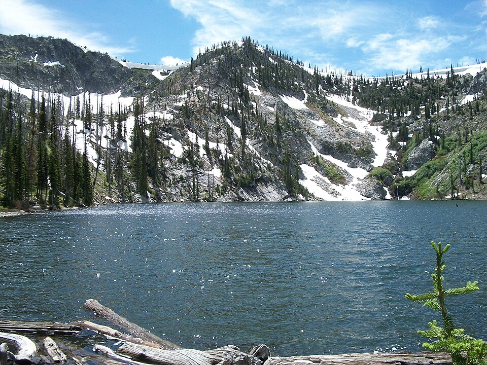
It’s a Friday in late August. You’ve driven up to McCall for the weekend, and you want to sleep by a lake.
Ponderosa State Park, on the edge of town, was full months ago. Its campground often books up by January. So you head out to Lost Valley Reservoir, where people camp right by the water for free.
When you get there, the water is a long way off. Ranchers have been drawing water from it since early July, and by late summer the shore has moved.
In June, the same trip goes the other way. Lost Valley is near its fullest, and the road up to the high lakes is often still under snow.
There are eight free camping areas within about an hour of McCall, and one more a little further. Here is how to pick the right one.
1. Don’t count on a booked campground
McCall is a small mountain town on Payette Lake, at about 5,000 feet. In summer it fills with visitors. The state park and the Forest Service campgrounds that take bookings go early.
None of the places below can be booked. You turn up, find an empty spot and stay. On a summer weekend, arrive early on Friday, or come midweek.
2. Match the lake to the month
June. Go low. Lost Valley Reservoir is at its fullest, and Paddy Flat and Rapid Creek sit in the forest south of town. The Lick Creek road to 33 Lake usually opens around the middle or end of June.
July to early September. Go high. The road to Goose Lake and Granite Lake is usually clear of snow from July. Goose Lake is at about 6,400 feet and Granite Lake at about 6,800. Upper Payette Lake is good once the ground dries out, late in July.
From September. Upper Payette Lake is drawn down from about the first of the month, and Lost Valley is low. The high lakes and the creek-side spots don’t change much. Smokey Boulder gets busy with hunters in September and October.
3. Check your vehicle can manage the road
The Goose Lake road is gravel, with washboard and potholes. An ordinary car can do it slowly. The last few miles to Granite Lake are rougher, and four-wheel drive is advised.
The Lick Creek road is paved for about five miles out of town, then turns to narrow gravel. It isn’t a road for an RV or a trailer.
The Warren Wagon Road north to Upper Payette Lake and Lake Creek is paved for about 30 miles. At Lost Valley, some tracks down to the water are deeply rutted. If you’re towing, read how to check a dirt road first.
4. Stock up in McCall
McCall has supermarkets and fuel. New Meadows and Donnelly have fuel and small stores. Out at the lakes there’s nothing to buy.
Don’t count on drinking water at any of them. Bring all you’ll need, plus some spare. A few have a toilet, and the rest have nothing at all. Carry out your trash.
Burgdorf Hot Springs, near Lake Creek, is private. You pay to soak, and you book ahead.
5. Keep food in the car and check the fire rules
Black bears live in the forest around McCall. Keep food, coolers and trash in a hard-sided vehicle, and never leave them out overnight.
In a dry summer the forest limits fires. Under the first stage of the rules, you can only light one in a fire ring at a developed site. Under the second stage, you can’t light one at all. In 2024 the first stage began in late July. Check the forest’s alerts before you strike a match.
6. Leave the site the way you found it
- You can stay up to 14 days in any 30 on the Payette National Forest.
- Use a fire ring where there is one, and only when the rules allow it.
- Keep your car on the bare ground, off the plants by the shore.
- In the fall, wear something bright if you walk in the woods.
Free campsites in this guide near McCall
Distances are by road from downtown McCall. Times on gravel are rough guesses.
- Goose Lake: 17 miles, about 50 minutes. Spots along a no-wake lake with trout, up the road toward Brundage Mountain. Outhouses and fire rings, no big RVs.
- Paddy Flat: 19 miles, about 50 minutes. Two small, quiet sites south of town. Good if you bring horses.
- Lost Valley Reservoir: 26 miles, about 55 minutes. Spots right by the water, best early in summer. Some tracks are rutted.
- Rapid Creek: 20 miles, about 55 minutes. Two sites beside a creek, with tables, fire rings and a toilet.
- Upper Payette Lake: 19 miles, about 55 minutes. Spots along the shore on either side of the paid campground. Wet ground through most of July.
- Granite Lake: 19 miles, about 55 minutes. Seven spots at a high lake, with tables and a toilet. Four-wheel drive advised.
- 33 Lake: 17 miles, about 1 hr 5 min. A bare camping area beside the Lick Creek road. No RVs.
- Smokey Boulder: 31 miles, about 1 hr 5 min. Spots along a forest road north of New Meadows. Busy with hunters in the fall.
- Lake Creek: 34 miles, about 1 hr 30 min. Spots beside a creek near Burgdorf, popular with ATV riders and horse owners.
Important: roads, water levels and fire rules around McCall change every season. Before you go, check the Payette National Forest’s alerts.
Find somewhere to camp
434 places to camp on public land across Idaho, Oregon, Utah, Arizona and Montana.